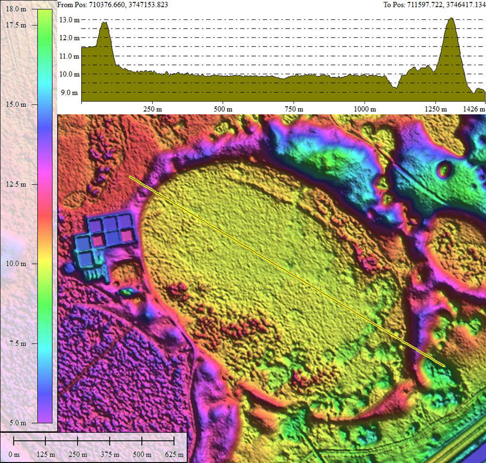
Elevation Profile maps have been created in Global Mapper GIS. These are driven by high resolution DEM data, or LiDAR point cloud data, and provide a glimpse into the vertical relief presented by Carolina bays. The slide deck contains over 400 elevation maps, so please be patient while it loads (<30 seconds). These images were created to support the Carolina Bay of the Day posts. They were originally generated using the Google + social network facility, but with its demise years ago was lost to the bit bucket in the sky. I have been slowly recreating them using my own web site and tools. But only ~130 so far.